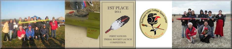
February 4, 2012, a clear 45 degree day in the Pacific Northwest, saw Skybolt fly her second test flight. A weighing error resulted in an altitude that was 1500 feet higher than predicted. A malfuntioning altimeter had no effect because of a 2nd error, but it fired the main charge at 1500 feet rather than the programmed 700 feet. That is the second time that this altimeter has done this. It’s being trashed and/or sent back to the manufacturer. The 2nd error was that the main was jammed into the parachute bay, which meant that it didn’t deploy. This, in fact, was fortunate. Winds at altitude carried the rocket a long distance to the west toward the ocean. Had the main deployed, the rocket surely would have landed somewhere in the Straits of Georgia.
Our GPS told us where it was; however, because of the wetlands, the semi-flooded areas, the streams and rivers, we had a heck of a time recovering it. After running around in blackberrys, wet ground, and fording streams, we finally recovered it nearly six hours after the launch, and nearly three hours after making visual contact. All was in good shape, not even wet!
It landed with the fin can upright in the soft mud on a 12x12x12 penninsula at the junction of a stream and a small river. Pictures are in the gallery as well as a video launch here.